Our experiences with the navigation in the expedition vehicle and what we have learned from it: hopefully a little aid. It is not a market overview.
Who explains navigation to a beginner?
Navigation is a matter of course nowadays and does not need to be explained. Everyone has a navigation system in the car, on the motorbike, on the MTB and for hiking, so where is the problem? In the familiar environment at home, we have for every situtation the optimal device and the right maps at hand.
The maps are already the first question mark, where can I get off-road maps? Do I need them at all? It is unlikely that many travelers will need real off-road maps, so called topo maps of places where there are no roads and tracks left.
The second question is then the device itself. In a truck, the device may be slightly larger, as it is mounted further away from the user. How does the communication work when the passenger navigates while the driver is driving?
Unfortunately, we did not receive any answers from our cabin builder on all these questions. We have not received satisfactory answers to these questions from other off-road vehicle builders either.
Only the best was good enough
On the web and later also on the all-wheel trade fair we met a specialist. He had a conclusive answer to all our questions. So, we bought from him quite a bit of equipment.
Our conditions:
- The passenger navigates
- The driver can also see the maps and routes
- We can load topo maps from all possible regions of the world onto the device
- The route is saved and can be read out
The solution was:
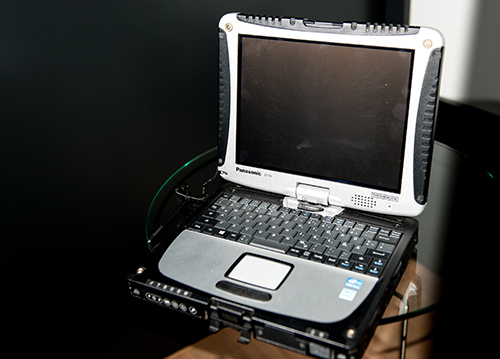
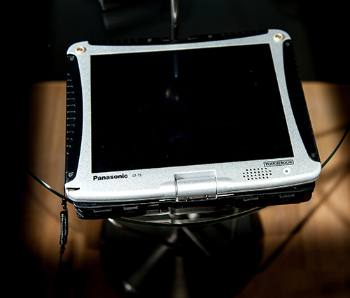
- Panasonic Toughbook
- Additional automotive display 10.4 “for the driver
- RAM mount system for the brackets
- Software QuoVadis
Complications
The explanation was very short for a variety of reasons and the software was quite complex. Anyway, we started with a plentiful set of maps that we had purchased. After a while we managed the simple work steps with the software better and better and were reasonably satisfied. The Toughbook was shipped with Windows 7 and we updated the operating software first to Windows 8 and then to 10. After about two months, the external GPS receiver bowed out more and more often. The PC no longer found a receiver. Navigation was no longer possible because the device did not know where we are. The device was not working properly anymore until the next day when we started the GPS again.
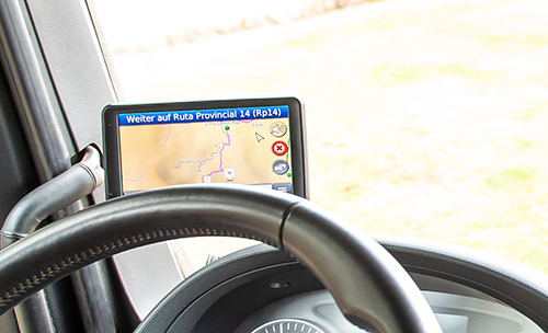
This has happened again in the middle of Namibia, in uninhabited terrain. We couldn’t find out exactly where we were. A little bit an uncomfortable situation. We were very insecure and the confidence in the equipment was no longer given. Of course, we found a street again and a small town with a shop where Garmin navigation systems were sold. We bought a Nüvi and immediately felt safer. So finally, the QuoVadis on Toughbook usually worked until the first stop once a day, then it lost the signal and was therefore no longer useful.
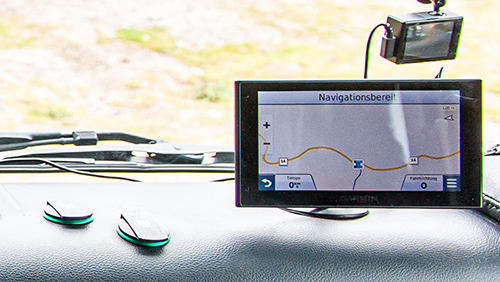
We had the PC reworked by the specialist and started again in South Africa, but with a Garmin Dezl 760 and the Nüvi in the backhand. The majority of the time QuoVadis did not work. We were completely disappointed.
Reduce to the max
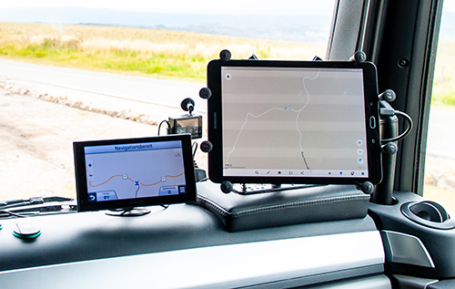
We then decided to give up the expensive equipment and switch to simpler hardware and software. Our preconditions have not changed. Instead of a PC, we bought a tablet on which we download MapsMe and Google maps, so that both systems are also available off-line. The Garmin Dezl 760, we mounted on the driver’s side and load it with the appropriate OSM maps, the Nüvi we load with purchased Garmin maps and it is mounted on the passenger’s side as a second option for the Navigator. We are now driving with three different navigation devices, which is actually a little over the top, but it gives us the confidence to always know where we are. For navigation it is also very interesting to use different maps and to see which map shows which way is possible.
Recommendations
If a journey through areas with less or bad map material is planned, we would always recommend taking more than one navigation device with you. A tablet and a Garmin or a similar device are a safe bet.
In Southern Africa we definitely recommend Tracks4Afrika. We’ve had very good experiences with the OSM cards, mostly they are more up to date than Garmin’s Here maps. In urban environments, however, Garmin maps are unbeatable, as accurate addresses can be entered as destinations. The Google maps are increasingly accurate even in remote places and you can also read the height. Unfortunately, topo maps outside of Europe are hard to find. We will test Gaia gps next.
OSM cards on Garmin: https://wiki.openstreetmap.org/wiki/User:Computerteddy#Start_Here.21_-.3EStandard_cards.C3.A4tze_.2F_mapsets_for_general_usage
Google Maps off-line: https://support.google.com/maps/answer/6291838?co=GENIE.Platform%3DAndroid&hl=en_US
Tracks4Afrika: https://www.tracks4africa.ch/
Topo Maps: https://www.gaiagps.com/ or http://garmin.opentopomap.org/
Thanks for this useful article, also for the others on this site. Have a look at Guru Maps as well. For us, it is the best platform ever. And we agree to at least two separate devices, we also use it to split between our main route and a deviation, for example for fuel, supplies or overnight stay.