We are on Gran Canaria without Globi, he would definitely be a bit too big for this island! Therefore, we were able to undertake the one or the other hike. We like the island a lot and the central mountains allow for some beautiful walking tours. We show the hikes that we particularly enjoyed. As always for download.
We hiked many of the island’s hills in the ninety days or so and covered more than 120 kilometers on foot.

Roque Nublo
It was a beautiful day, and we reached the small parking lot just in time before it was completely full. The circular route around the Roque is cozy with great views and completely lonely. The entire masses of people all flow on the direct route to the Roque, respectively at its bottom. The rock is very impressive, and it is worth going up even if there is a larger run on the rock.
For the 4.9km we needed a total of 2h10, of which we paused for half an hour and enjoyed the view.
Culata-Goleta
We start at the lowest point at Culeta and enjoy the beautifully landscaped path that leads up steeply through the forest to Goleta. Shortly before Goleta you can turn left so that you don’t have to hike along the driveway. After El Garañón the view over the valley with the Nublo, the Bentayga and the Teide on Tenerife is sensational. The hiking trail steeply down through the village of Culata is very pleasant.
For the 9.3km we needed 4h20, of which we paused for over 1h.
Asserador – Cruz Huesita
From the parking lot to El Juncal de Abajo, the hiking trail leads for the most part on an asphalt road, which is almost not used. From here it goes comfortably on a forest path to Cruz Huesita. In Cruz de Huesita the hike just becomes fantastic, sensational views and a beautiful mountain hiking trail.
For the 12.3km we needed 5h40, but we stayed at various points of it for a total of 1h35.
Pico de las Nieves
A bit steeper at the beginning, but the view from the Pico even makes up for the fact that you can get here by car as well. We had a sensational day. The way back through the light coniferous forest with many views is very gentle and pleasant.
For the 7.5km we needed 3h. Though on the Pico we spent about 30 ’to enjoy the sensational view.
Santa Lucia – Fortaleza
We started at the lowest point and hiked the idyllic path to Santa Lucia. We left Santa Lucia on the left and turned straight back into the beautiful valley. At the cemetery and further on to Fortaleza, the path leads a short while over the driveway.
For the 10.1km we hiked 3h and half an hour we paused.
Coruna las Hoyas
A lonely hike through the burned down spruce forest. The forest was once dense, now it is clearly brighter. However, new shoots are already growing on the spruce trees. The trails are not really well signposted, but still easy to find. The ground is wonderfully soft thanks to the many spruce needles.
We hiked the almost 6km in 2 hours, we also paused for about 10 ‘.
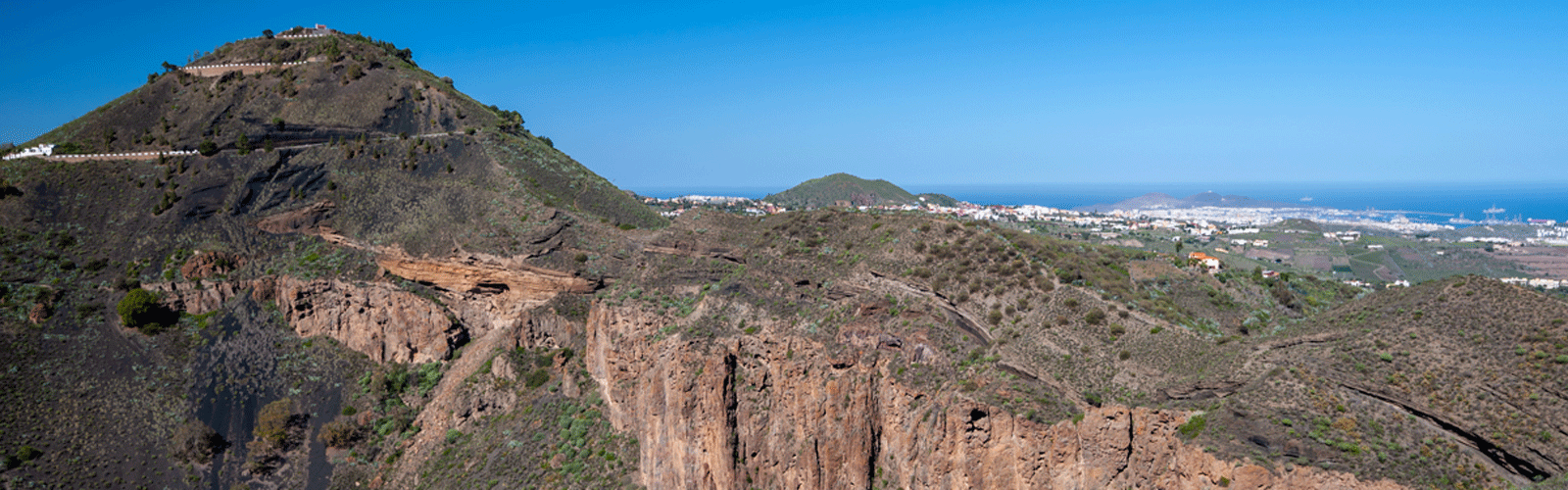
Bandama crater
The Bandama crater is impressive and quite steep, probably very strenuous in the heat. We went down into the crater first and hiked afterwards around the entire crater on the crater wall. We needed 3 hours for the hike with a half hour break.
Altavista
The ascent to the Altavista panoramic mountain begins at the Mirador del Sargento and leads over the mountain flank to the peak of the Altavista. The all-round view on the mountaintop is fantastic and an experience.
For the 8.9km there and back we needed 3h hiking time and 1h break and enjoy the view.
Acusa
There is a convenient car park just before the junction for Acusa Seco. It is also possible to park in Acusa Seco itself. The hike from Acusa Seco to Acusa Verde is sensational. A beautiful hiking trail along the ancient Canarian caves. From Acusa Seco back to the parking lot we walk on the tar road! The second part of the hike is not worth it. Parking in Acusa Seco and walking there and back would definitely be the better solution.
For the 7.2km we need a total of 2h20. On the way, however, we marveled at the caves and the landscape for over 20 minutes.
Degollada de Dinero
The ascent to the Degolladas de Manzanilla and Dinero is beautifully laid out and not too steep. The view from the pass on both sides is very impressive. Then an easy hike on a driveway to a shortcut on an idyllic hiking trail. The descent from the Cruz Grande is again very lovely.
For the 13.8km we needed 4 hours in addition, we enjoyed the view for about 40 minutes.
Pico Bandera
The circular hike starts at Casa Forestal with easy parking. The entire hike is in the sparse forest. On the Pico, the detour to the observation tower is an absolute must. The tower is closed, but from the base platform the view of the sea is unique.
We completed the short tour of 3.5 km in 1h20 and enjoyed the view for over 10 minutes.
Tejeda-Timagada
The ascent to Timagada on a small path leads through many remains of recent rock falls. Obviously the rock is quite moving here. Many retaining walls had to give in to the pressure of the mountain. The Timagada viewing platform is very nicely designed and the view is beautiful.
We hiked the 6.5km in 2h15 in addition, we stood for about 20 minutes to enjoy the view.
Becerra circuit
The Becerra circuit is a circular hike in the center of the island with beautiful views as far as Canteras Bay. We needed 2h40 including a half hour break.
Dunes of Maspalmas
The hikes through the dunes of Maspalmas are very special. The beach is wonderful. A large part of the beach is a nudist paradise and is probably quite crowded in the high season. On the way back through the dunes at the back, you almost feel like you’re in a North African desert. For the hike we needed 2h45 with a 20 minutes break.
Playa del Confital
The Playa del Confital begins at the parking garage at La Puntilla in Las Palmas and leads after the promenade on a very nicely developed footbridge along the coast, back over the ridge with a great view of Las Palmas on both sides of the Isleta. In the end we took a shortcut because we didn’t want to hike on the street, the last two meters are associated with a little climbing. We needed 1h45 with a 20 minutes break.
Cuevas de Cuatro Puertas
In the empty caves you can well imagine how the natives lived here, what a village looked like and how close they lived together. The caves are built in a fantastic place with a sensational view.
For the short hike from the parking lot, we needed about 0.5 hours and at least the same amount of time to visit the caves.
Around Santa Brigida
In a kind of water channel, without water, you can go around the village of Santa Brigida. The climb back to Santa Brigida was not very easy to find and in our case very slippery after the rain.
For the 4.1km we needed 1h40, of which we stopped for about half an hour to look around and take pictures.
Wow … A truly wonderful adventure you are undertaking in a area not explored by common tourists.
I imagine the culture is originally virgin so to speak, without the commercial pressures which affect many other places through commercialism, tourism, and politics.
Are you eager to move on, or do you look forward to spending more time there?
Happy Christmas and safe travels.
Kind regards, John
Hi John
we try to stay here untill the border from Argentina and Uruguay open again! we hope at least in March 21.